What are these poles??
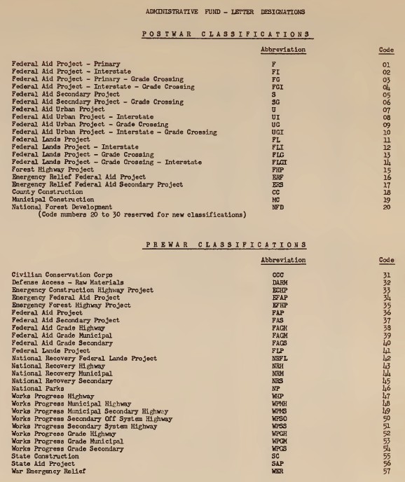
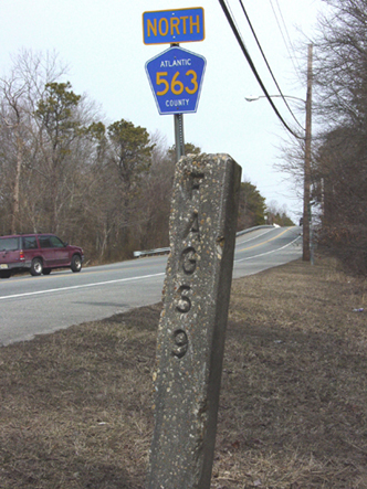
UPDATE!!! MYSTERY SOLVED!FAGS9 = Project Number for Federal Aid Grade Secondary (road).
Over the years I have frequently checked online using a variety of search terms, but new material comes up all the time. I just did another search and hit gold...
Two sites came up with inventories of such numbers: one for the State of Utah, and one for Florida
Utah Road Commission Federally Funded Highway Construction Project Files
Twelfth Biennial Report of the State Road Department of the State of Florida, 1937-1938
The Utah site helpfully explained some of the acronyms:
"This series contains records of federally funded highway construction projects in Utah. The construction of these highways was primarily the result of the Federal Aid Highway Act of 1944, and the Federal Aid Highway Act of 1956. Records are arranged by project number and typically include correspondence, financial records, and general information on the construction of individual highways, bridges, and other infrastructure throughout Utah. Project files are numbered chronologically by federal-aid primary highway system (F.A.P.) number or federal-aid secondary highway system (F.A.S.) number. Also present are right of way (RW) project records, as well as treasury reports from 1972."
And a third site, for Montana:
1953 Montana Federal-Aid Road Log
included a full page of spelled out acronyms used by the Federal Highway folks.
CLOSURE!!! :-)
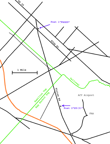
Two triangular concrete poles, about 3 miles apart:
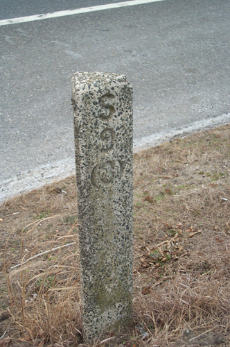
1) East side of Tilton Road in Galloway Township, New Jersey, between crossing with Aloe Road and the railroad overpass:(approximately -74.6056 39.4945). Marked "FAGS9":
Left: from south, looking north (photo credit: Dave Lind).
Right: From north, looking south.
Third side blank.
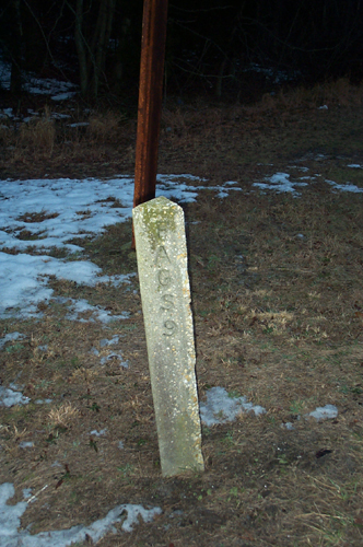
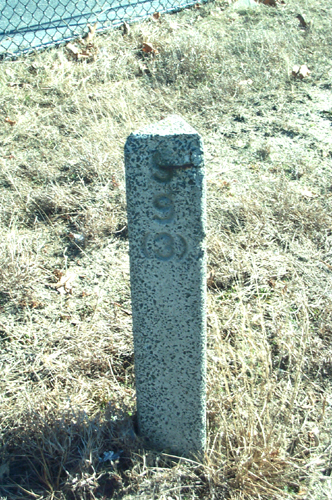
2) East side of Tilton Road in Egg Harbor Township, across from dirt road that goes to an experimental VORTAC (not the operational Atlantic City VORTAC which is visible inside the fence).
(approximately -74.5891 39.4497). Marked "S9(3)":
Left: from north, looking south.
Right: From east, looking west.
Third side blank.
Click here for hi-res
Possible explanations:
1) old mile-posts
2) Railroad Right-of-Way markers
3) Projects of the The Federation of Astronomical and Geophysical Data Analysis Services (FAGS)
****** [EARLIER] UPDATE !!! ********
After 6 years, another pole has been spotted!
3) Southernmost corner at 60th and Landis Avenue in Sea Isle City, New Jersey,(approximately -74.70124 39.14276). Marked "FAS112(1)":
(photo credit: Stephen Amadei).
crop.jpg)
Last updated: 2015 Twelfth Month, 14th.